
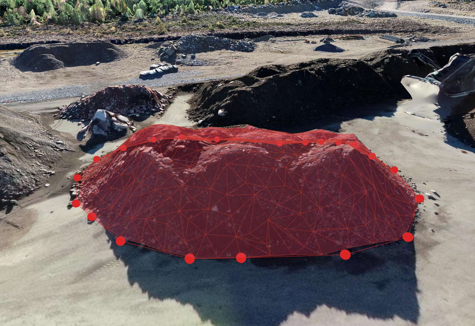
Measuring volume from drone data
A drone flight gives you a dense elevation model (DSM) or point cloud of a surface. To get a volume you compare that surface to a base surface and integrate the height difference over the area — the classic cut/fill calculation. It's ideal for stockpiles, excavations, landfill, quarry faces and earthworks progress, and it's far faster and safer than measuring a pile by hand.
How it works
The software overlays a grid on your boundary, and at each cell multiplies the height difference (surface minus base) by the cell area, then sums them: Volume = Σ Δh × cell area. Fine cells and a good GSD make the result smooth and accurate. Cut (material to remove) and fill (material to add) are reported separately, plus the net.
Choosing a base surface
The base surface is the biggest decision, especially on sloping ground:
- Best-fit / lowest plane — quick, good for a pile on flat ground.
- Triangulated (TIN) from the boundary — drapes a surface across the toe of the pile, correct for uneven ground; the usual choice for stockpiles on a slope.
- Custom or design surface — compare against a survey or a CAD design to get progress or remaining earthworks.
Using the wrong base is the #1 cause of volume disputes.
How accurate are drone volumes?
With good overlap, a low GSD and proper ground control, drone stockpile volumes are typically within 1–2% of ground truth — comparable to a GNSS-rover survey and usually far more consistent than manual methods. Accuracy depends on GSD, base-surface choice, how cleanly the toe of the pile is defined, and your GCPs. Vegetation, standing water and moving material are the main enemies.
Best practices for accurate volumes
- Fly with strong overlap (≥80/70%) and a low GSD; add oblique images for tall piles.
- Use ground control (or RTK) so the surface is correctly scaled and placed.
- Capture the pile when it's static — no loaders working.
- Define a clean boundary at the true toe of the pile; avoid including surrounding ground.
- Avoid vegetation and standing water on the surface.
- Use the same method each time so period-to-period comparisons are consistent.
Stockpiles, cut/fill and progress over time
Beyond a single pile, volumes drive reconciliation (compare surveyed stockpile to book/haul records), earthworks progress (cut/fill against a design surface), and change over time (compare two flights of the same site to see how much material moved between dates). Repeat flights turn a drone into a monthly or weekly measurement tool for a whole site.
How Orthosite measures volume
In Orthosite you draw a boundary on the model, choose a base-surface method (best-fit plane, triangulated toe, or a custom/imported surface), and the server computes a full-resolution cut/fill volume — not a coarse approximation. It reports cut, fill and net, works in your chosen coordinate system and units (m or ft), and exports a PDF and CSV report you can hand to a client. Fly the same site again and compare to measure change over time.
FAQ
How accurate is drone volume measurement?
What base surface should I use?
Can I measure a stockpile on a slope?
Does vegetation affect volumes?
Can I track volume change over time?
Can I export the volume report?
Tee seuraavasta lennostasi mittaustarkka tulos
Lataa dronekuvasi, niin Orthosite rakentaa ortomosaiikin, 3D-mallin, pistepilven ja korkeusmallit pilvessä — mittaa, jaa ja vie avoimissa formaateissa.
Aloita Orthositen käyttö