
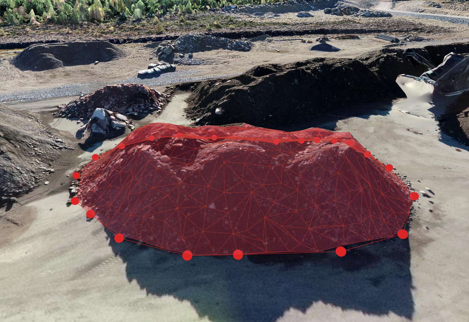
Measuring volume from drone data
A drone flight gives you a dense elevation model (DSM) or point cloud of a surface. To get a volume you compare that surface to a base surface and integrate the height difference over the area — the classic cut/fill calculation. It's ideal for stockpiles, excavations, landfill, quarry faces and earthworks progress, and it's far faster and safer than measuring a pile by hand.
How it works
The software overlays a grid on your boundary, and at each cell multiplies the height difference (surface minus base) by the cell area, then sums them: Volume = Σ Δh × cell area. Fine cells and a good GSD make the result smooth and accurate. Cut (material to remove) and fill (material to add) are reported separately, plus the net.
Choosing a base surface
The base surface is the biggest decision, especially on sloping ground:
- Best-fit / lowest plane — quick, good for a pile on flat ground.
- Triangulated (TIN) from the boundary — drapes a surface across the toe of the pile, correct for uneven ground; the usual choice for stockpiles on a slope.
- Custom or design surface — compare against a survey or a CAD design to get progress or remaining earthworks.
Using the wrong base is the #1 cause of volume disputes.
How accurate are drone volumes?
With good overlap, a low GSD and proper ground control, drone stockpile volumes are typically within 1–2% of ground truth — comparable to a GNSS-rover survey and usually far more consistent than manual methods. Accuracy depends on GSD, base-surface choice, how cleanly the toe of the pile is defined, and your GCPs. Vegetation, standing water and moving material are the main enemies.
Best practices for accurate volumes
- Fly with strong overlap (≥80/70%) and a low GSD; add oblique images for tall piles.
- Use ground control (or RTK) so the surface is correctly scaled and placed.
- Capture the pile when it's static — no loaders working.
- Define a clean boundary at the true toe of the pile; avoid including surrounding ground.
- Avoid vegetation and standing water on the surface.
- Use the same method each time so period-to-period comparisons are consistent.
Stockpiles, cut/fill and progress over time
Beyond a single pile, volumes drive reconciliation (compare surveyed stockpile to book/haul records), earthworks progress (cut/fill against a design surface), and change over time (compare two flights of the same site to see how much material moved between dates). Repeat flights turn a drone into a monthly or weekly measurement tool for a whole site.
How Orthosite measures volume
In Orthosite you draw a boundary on the model, choose a base-surface method (best-fit plane, triangulated toe, or a custom/imported surface), and the server computes a full-resolution cut/fill volume — not a coarse approximation. It reports cut, fill and net, works in your chosen coordinate system and units (m or ft), and exports a PDF and CSV report you can hand to a client. Fly the same site again and compare to measure change over time.
FAQ
How accurate is drone volume measurement?
What base surface should I use?
Can I measure a stockpile on a slope?
Does vegetation affect volumes?
Can I track volume change over time?
Can I export the volume report?
Transformez votre prochain vol en résultat de qualité topographique
Importez vos photos de drone et Orthosite génère l'orthomosaïque, le modèle 3D, le nuage de points et les modèles d'élévation dans le cloud — mesurez, partagez et exportez dans des formats ouverts.
Commencer avec Orthosite