
Why construction teams use drone mapping
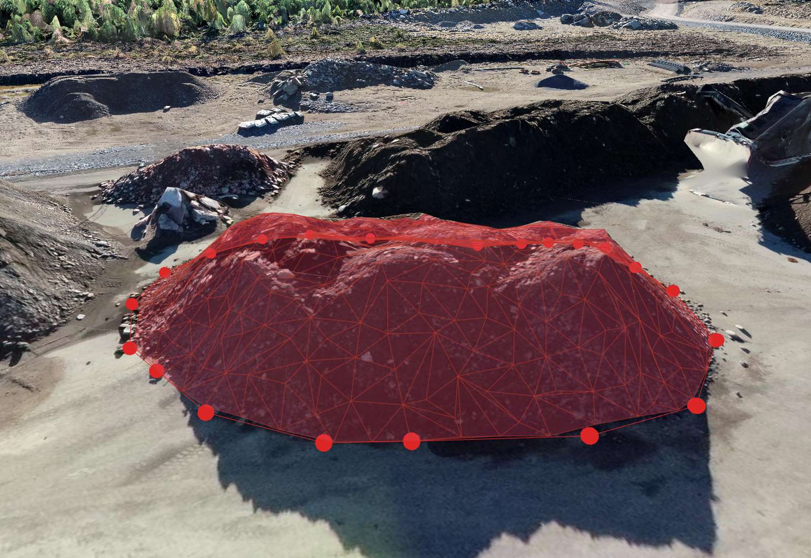
A weekly or monthly flight gives you an accurate, dated record of the whole site without walking it. That drives four things: progress tracking (see what changed), earthwork volumes (cut/fill and stockpiles), as-built documentation, and communication — a shared visual everyone from the site engineer to the client can open in a browser. It's faster and safer than sending people across live earthworks.
What you can deliver on a construction site
- Orthomosaic — a to-scale site map for planning and markup.
- DSM / DTM — surface and bare-earth models for grading and drainage.
- Volumes — stockpiles, cut and fill (see the volume guide).
- Cut/fill vs design — compare the current surface to a CAD design to see what's left to move.
- Contours & cross-sections — for roads, drains and platforms.
- 3D model — for stakeholder walkthroughs and clash spotting.
Tracking progress over time
The real power is repetition. Fly the same site on a regular cadence, and you can compare any two dates: how much earth moved, how a structure rose, whether the programme is on track. Consistent flights (same plan, same control) make the comparison trustworthy, and a shared timeline keeps the client and the site team looking at the same evidence rather than arguing from memory.
Earthworks: cut/fill against a design
For earthworks, the money question is "how much is left?". Import your design surface (LandXML, DXF or a TIN) and compare it to the current drone surface: Orthosite reports the cut and fill between them, so you can measure remaining earthworks, reconcile with haul records, and value work done — all in your project coordinate system.
Keeping it accurate enough to build from
Construction deliverables need defensible accuracy. Use ground control points (or an RTK/PPK drone), keep a few checkpoints back, and read the RMSE report to certify the survey (see the GCP & accuracy guide). Work in the site's official coordinate system and vertical datum so drone data lines up with the design and the surveyor's control.
A typical site workflow
Plan a repeatable grid over the site; fly it on your cadence (weekly for active earthworks, monthly for slower phases); upload the images to Orthosite; mark GCPs; process; then measure volumes and progress and share a link with the project team. Because it runs in the browser and processes in the cloud, the site engineer doesn't need a workstation — just the images and a login.
FAQ
How often should I fly a construction site?
How accurate is drone data for construction?
Can I compare the site to my design?
Can I share results with the whole team?
What do I need to get started?
Transformez votre prochain vol en résultat de qualité topographique
Importez vos photos de drone et Orthosite génère l'orthomosaïque, le modèle 3D, le nuage de points et les modèles d'élévation dans le cloud — mesurez, partagez et exportez dans des formats ouverts.
Commencer avec Orthosite