
Why you can measure on a drone map
A processed drone map is georeferenced and to scale: every point sits in its true position, and elevation models store a real height at each location. That means a line you draw on the map is a true ground distance, a polygon is a true area, and the surface under a boundary is a real volume — no tape measure or site visit required. Accuracy comes from your GSD and ground control (see the accuracy guide).
Distance — horizontal vs slope
Two distances matter and they differ on slopes. Slope (3D) distance follows the terrain surface; horizontal (grid) distance is the map/plan distance. Total stations report both, and so should your software — use horizontal for setting-out and plan quantities, slope for surface lengths. Orthosite reports both, per segment and as a total.
Area
Area is measured as the horizontal (plan) footprint of a polygon — the correct surveying convention — so it matches how parcels, pavements and footprints are quantified. Draw the boundary on the orthomosaic or 3D model and read the area in m² (or ft², acres, hectares).
Volume (cut and fill)
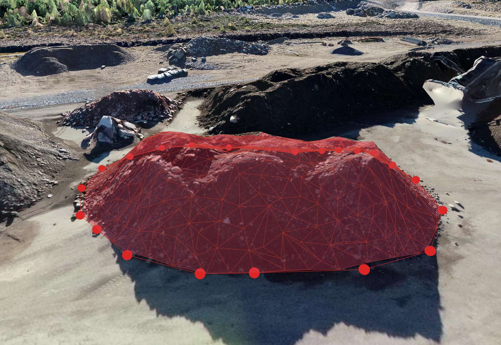
Volume is the material between the surface and a base you choose (a plane, a triangulated toe, or a design surface), reported as cut, fill and net. It's the go-to for stockpiles and earthworks — the volume guide covers base-surface choice and accuracy in depth.
Height differences and elevation
Read the elevation at any point from the model, or measure the height difference between two points — plus the slope angle between them. Useful for checking level, batter slopes, retaining heights and clearances, all in your project's vertical datum.
Cross-section profiles
A profile is a slice of elevation along a line — draw a line across a road, drain, embankment or slope and get its long-section. It's one of the most useful survey outputs for linear works, and Orthosite draws it directly on the model and exports the chainage/elevation data.
Units, coordinates and exports
Measurements are only right if the units and coordinate system are right. Set your project CRS and vertical datum (see the coordinate-systems guide) and toggle metres or feet anytime — every measurement and report updates. Export measurements and volume reports to PDF and CSV, and geometry to DXF/GeoJSON/LandXML, all in your chosen system.
FAQ
How accurate are measurements on a drone map?
What's the difference between horizontal and slope distance?
Can I measure volumes?
Can I change between metres and feet?
Can I export my measurements?
Gjør din neste flyvning til et survey-grade resultat
Last opp dronebildene dine, så bygger Orthosite ortofoto, 3D-modell, punktsky og høydemodeller i skyen — mål, del og eksporter i åpne formater.
Kom i gang med Orthosite